Calgary stands where the Bow River meets the Elbow, on the rolling prairie of southern Alberta, about an hour's drive east of the front ranges of the Rocky Mountains. On a clear day the mountains show along the western horizon from the city's hills. Most visitors treat the city as an airport on the way to Banff, which is a pity: it is worth a day or two of its own, and in early July it is the whole point.
Two rivers and a fort
The land where the rivers meet has long been a gathering place for the Blackfoot, Tsuut'ina and Stoney Nakoda peoples, and the city lies within the area of Treaty 7, signed in 1877. Two years before that, the North-West Mounted Police built a post at the confluence, Fort Calgary, and the town grew around it after the railway arrived in the 1880s. Ranching made it prosperous, and oil and gas in the twentieth century made it a city of glass towers.
The site of the fort is now a park and interpretive centre at the meeting of the rivers. It is a good place to begin, because it shows how the city is laid out: water first, then everything else.
The Bow River pathways and Prince's Island
Calgary has one of the longest networks of urban pathways in North America, hundreds of kilometres of paved trails for walking and cycling, with the best of them following the Bow and the Elbow through the middle of the city. You can walk from downtown along the river for an hour in either direction without crossing a road, past cottonwoods, gravel bars, anglers and Canada geese.
Prince's Island Park sits in the Bow just north of downtown, reached by footbridges, with lawns, shade trees and a lagoon. In summer it hosts outdoor festivals and fills with office workers at lunch. Just upstream, the Peace Bridge, a red tubular span for walkers and cyclists designed by Santiago Calatrava, crosses the river to the northern bank. The river is cold and fast, fed by mountain snow and glaciers; people do float it on hot days, but only with proper equipment and knowledge of the weirs and currents.
Downtown itself is laced with the Plus 15, a network of enclosed walkways about fifteen feet above the street that links many of the office towers, useful on a cold day. The Central Library, opened in 2018 at the eastern edge of downtown, has a striking wooden interior that is worth a look even if you are not borrowing anything.
The Stampede in July
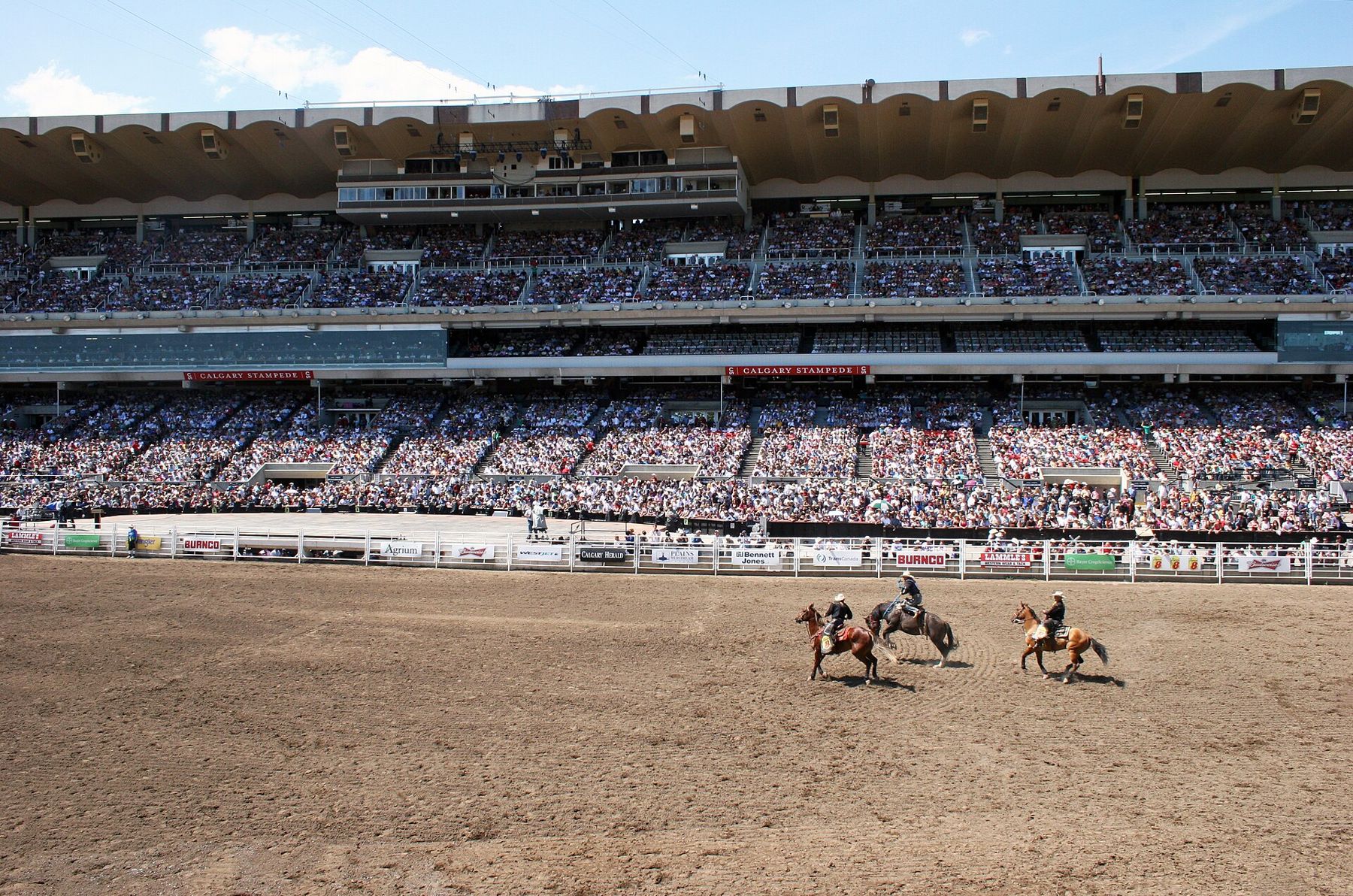
For ten days in early July each year, the Calgary Stampede takes over the city. It began in 1912 and has grown into one of the largest rodeos in the world, with bronc and bull riding, roping, barrel racing and the chuckwagon races in the evenings, as well as a parade, agricultural shows, a midway and concerts on the Stampede grounds just southeast of downtown. Much of the city joins in: offices put on breakfasts, and western hats and boots appear on people who wear them on no other days of the year.
If you plan to come for the Stampede, book a place to sleep well ahead, because the city fills, and expect prices to rise. Grandstand seats for the rodeo and evening shows are sold separately from grounds admission. Dates, prices and schedules change, so check before you go.
Fish Creek and the edges of the city
In the south of the city, Fish Creek Provincial Park follows a creek valley for kilometres, from the edge of the foothills to the Bow. It is one of the largest urban parks in Canada, with aspen and spruce woods, grassland, wetlands, and deer, coyotes and birds of prey that seem unbothered by the houses on the ridges above. The paths are good for walking or cycling, and the creek-side picnic areas fill on summer weekends.
West of the city, Canada Olympic Park, built for the 1988 Winter Olympics, is still visible from the highway with its ski jumps against the sky, a reminder that the Games came here.
Chinooks and the seasons
Calgary's weather is famously changeable. In winter, a warm, dry wind from the west, the chinook, can come over the mountains and lift the temperature dramatically in a few hours, melting snow and leaving an arch of clear sky over the Rockies. It can also go the other way. Snow is possible in any month except perhaps July and August, and summer brings strong thunderstorms, sometimes with hail.
- June to September is the main season, with long daylight and warm, dry days.
- Early July is Stampede time: lively, expensive and crowded.
- Winter is cold but bright, and the mountains offer skiing within a couple of hours.
The drive west to Banff
The Trans-Canada Highway runs west from the city across the foothills, and the mountains rise ahead of you all the way. After about an hour you pass Canmore, at the mouth of the Bow Valley, and shortly after that you reach the gates of Banff National Park. A park pass is required for every vehicle that stops in the park; types and prices change, so check before you go. Banff town is a short way beyond the gate, and Lake Louise is further west along the same valley. Access to some of the most popular lakes is now restricted to shuttles or limited parking, so plan those visits in advance.
Wildlife is part of the drive: elk, bighorn sheep and bears are seen along the roads. Stay in your car, keep your distance and never feed them. If you are hiking, carry bear spray and know how to use it.
Visitors from the United States need a passport or another accepted document to enter Canada and to return; distances are in kilometres and speed limits in kilometres per hour. For an American mountain town with a similar mix of skiing and summer hiking, see Aspen; for another border crossing, Niagara Falls on the New York side. Our list for packing for a road trip works for this one too.